
Cheney topographic map
Interactive map
Click on the map to display elevation.
About this map
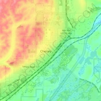
Name: Cheney topographic map, elevation, terrain.
Location: Cheney, Spokane County, Washington, United States (47.46535 -117.61154 47.51372 -117.54856)
Average elevation: 2,388 ft
Minimum elevation: 2,264 ft
Maximum elevation: 2,575 ft
Cheney is located at 47°29′19″N 117°34′43″W / 47.48861°N 117.57861°W / 47.48861; -117.57861 (47.488634, -117.578581), at an elevation of 2,400 ft (730 m).
Other topographic maps
Click on a map to view its topography, its elevation and its terrain.
Spokane
United States > Washington > Spokane County
Spokane, Spokane County, Washington, United States
Average elevation: 2,149 ft
Newman Lake
United States > Washington > Spokane County
Newman Lake, Spokane County, Washington, 99025, United States
Average elevation: 2,169 ft
Hog Lake
United States > Washington > Spokane County
Hog Lake, Spokane County, Washington, United States
Average elevation: 2,178 ft
Silver Lake
United States > Washington > Spokane County
Silver Lake, Spokane County, Washington, 99022, United States
Average elevation: 2,431 ft
Mead
United States > Washington > Spokane County
Mead, Spokane County, Washington, 99021, United States
Average elevation: 1,919 ft
Country Homes
United States > Washington > Spokane County
Country Homes, Spokane County, Washington, 99251, United States
Average elevation: 1,965 ft
Airway Heights
United States > Washington > Spokane County
Airway Heights, Spokane County, Washington, 99001, United States
Average elevation: 2,375 ft
Millwood
United States > Washington > Spokane County
Millwood, Spokane County, Washington, United States
Average elevation: 1,969 ft
Deer Park
United States > Washington > Spokane County
Deer Park, Spokane County, Washington, 99006, United States
Average elevation: 2,159 ft
Mount Spokane
United States > Washington > Spokane County
Mount Spokane, Spokane County, Washington, United States
Average elevation: 4,839 ft
Spokane Valley
United States > Washington > Spokane County
Spokane Valley, Spokane County, Washington, United States
Average elevation: 2,208 ft
Liberty Lake
United States > Washington > Spokane County
Liberty Lake, Spokane County, Washington, 99019, United States
Average elevation: 2,113 ft
Nine Mile Falls
United States > Washington > Spokane County
Nine Mile Falls, Spokane County, Washington, 99026, United States
Average elevation: 1,759 ft
Riverside State Park
United States > Washington > Spokane County > Spokane
Riverside State Park, Spokane, Spokane County, Washington, United States
Average elevation: 2,116 ft
Medical Lake
United States > Washington > Spokane County
Medical Lake, Spokane County, Washington, 99022, United States
Average elevation: 2,421 ft
Medical Lake
United States > Washington > Spokane County > Medical Lake > Medical Lake
Medical Lake, Spokane County, Washington, 99022, United States
Average elevation: 2,451 ft
Chattaroy
United States > Washington > Spokane County > Chattaroy
Chattaroy, Spokane County, Washington, 99005, United States
Average elevation: 1,834 ft