
Harpeth topographic map
Interactive map
Click on the map to display elevation.
About this map
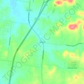
Name: Harpeth topographic map, elevation, terrain.
Location: Harpeth, Williamson County, Tennessee, USA (35.77896 -86.86417 35.81896 -86.82417)
Average elevation: 823 ft
Minimum elevation: 725 ft
Maximum elevation: 1,020 ft