
Greenmont topographic map
Interactive map
Click on the map to display elevation.
About this map
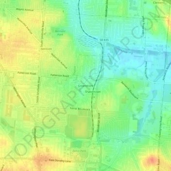
Name: Greenmont topographic map, elevation, terrain.
Average elevation: 925 ft
Minimum elevation: 860 ft
Maximum elevation: 1,001 ft
Other topographic maps
Click on a map to view its topography, its elevation and its terrain.
Berkley Heights
United States > Ohio > Montgomery County > Kettering
Berkley Heights, Kettering, Montgomery County, Ohio, 45439, United States
Average elevation: 830 ft
Pasadena
United States > Ohio > Montgomery County > Kettering
Pasadena, Kettering, Montgomery County, Ohio, 45429, United States
Average elevation: 981 ft
Oakdale
United States > Ohio > Montgomery County > Kettering
Oakdale, Kettering, Montgomery County, Ohio, 45429, United States
Average elevation: 974 ft