
South Egremont topographic map
Interactive map
Click on the map to display elevation.
About this map
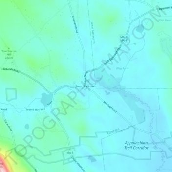
Name: South Egremont topographic map, elevation, terrain.
Average elevation: 781 ft
Minimum elevation: 666 ft
Maximum elevation: 1,565 ft
Other topographic maps
Click on a map to view its topography, its elevation and its terrain.
Jug End State Reservation & Wildlife Management Area
United States > Massachusetts > Berkshire County > Egremont > Mount Washington
Jug End State Reservation & Wildlife Management Area, Mount Washington, Egremont, Berkshire County, Massachusetts, United States
Average elevation: 1,342 ft