
Þingvellir National Park topographic map
Interactive map
Click on the map to display elevation.
About this map
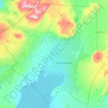
Name: Þingvellir National Park topographic map, elevation, terrain.
Average elevation: 1,037 ft
Minimum elevation: 308 ft
Maximum elevation: 3,488 ft
Other topographic maps
Click on a map to view its topography, its elevation and its terrain.
Geysir
Geysir, Haukadalsvegur, Bláskógabyggð, Southern Region, Iceland
Average elevation: 381 ft
Thingvellir
Thingvellir, Bláskógabyggð, Southern Region, Iceland
Average elevation: 397 ft
Laugarvatn
Iceland > Bláskógabyggð > Laugarvatn
Laugarvatn, Bláskógabyggð, Southern Region, Iceland
Average elevation: 220 ft
Skjaldbreiður
Skjaldbreiður, Bláskógabyggð, Southern Region, Iceland
Average elevation: 2,986 ft