
Adelaide River topographic map
Interactive map
Click on the map to display elevation.
About this map
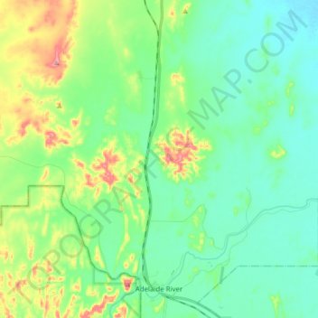
Name: Adelaide River topographic map, elevation, terrain.
Average elevation: 223 ft
Minimum elevation: 92 ft
Maximum elevation: 584 ft
Other topographic maps
Click on a map to view its topography, its elevation and its terrain.
Amangal
Australia > Coomalie Shire > Adelaide River
Amangal, Adelaide River, Coomalie Shire, Northern Territory, 0846, Australia
Average elevation: 210 ft