
Cintalapa topographic map
Interactive map
Click on the map to display elevation.
About this map
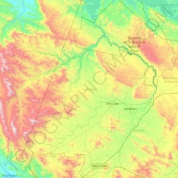
Name: Cintalapa topographic map, elevation, terrain.
Location: Cintalapa, Chiapas, Mexico (16.36609 -94.13916 17.13696 -93.55509)
Average elevation: 2,500 ft
Minimum elevation: 161 ft
Maximum elevation: 6,627 ft