
Floreffe topographic map
Interactive map
Click on the map to display elevation.
About this map
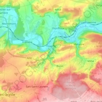
Name: Floreffe topographic map, elevation, terrain.
Location: Floreffe, Namur, Wallonia, 5150, Belgium (50.39288 4.69518 50.47191 4.82961)
Average elevation: 545 ft
Minimum elevation: 256 ft
Maximum elevation: 866 ft