
Municipio José Rafael Revenga topographic map
Interactive map
Click on the map to display elevation.
About this map
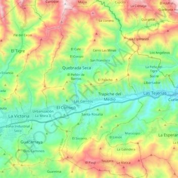
Name: Municipio José Rafael Revenga topographic map, elevation, terrain.
Location: Municipio José Rafael Revenga, Aragua State, 2118, Venezuela (10.17290 -67.29662 10.35337 -67.18627)
Average elevation: 3,071 ft
Minimum elevation: 1,529 ft
Maximum elevation: 6,122 ft
Other topographic maps
Click on a map to view its topography, its elevation and its terrain.
San Mateo
Venezuela > Aragua State > Municipio Bolívar
San Mateo, Parroquia San Mateo, Municipio Bolívar, Aragua State, 2120, Venezuela
Average elevation: 2,710 ft
Cagua
Venezuela > Aragua State > Municipio Sucre
Cagua, Parroquia Cagua, Municipio Sucre, Aragua State, 2122, Venezuela
Average elevation: 2,280 ft