
El Tambo topographic map
Interactive map
Click on the map to display elevation.
About this map
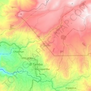
Name: El Tambo topographic map, elevation, terrain.
Location: El Tambo, Cañar, Ecuador (-2.53583 -78.98693 -2.42969 -78.85521)
Average elevation: 11,329 ft
Minimum elevation: 8,166 ft
Maximum elevation: 14,091 ft
Other topographic maps
Click on a map to view its topography, its elevation and its terrain.
San Miguel de Porotos
San Miguel de Porotos, San Miguel, Azogues, Cañar, 030154, Ecuador
Average elevation: 8,740 ft