
Bușteni topographic map
Interactive map
Click on the map to display elevation.
About this map
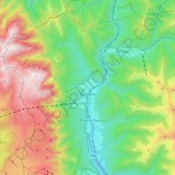
Name: Bușteni topographic map, elevation, terrain.
Location: Bușteni, Prahova, Romania (45.36783 25.45256 45.47040 25.62365)
Average elevation: 4,656 ft
Minimum elevation: 2,648 ft
Maximum elevation: 8,202 ft