
Alexandra topographic map
Interactive map
Click on the map to display elevation.
About this map
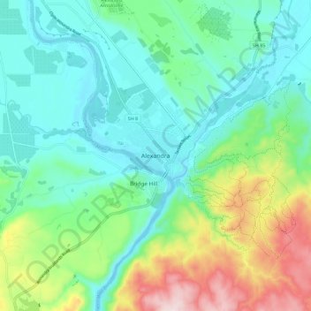
Name: Alexandra topographic map, elevation, terrain.
Average elevation: 791 ft
Minimum elevation: 433 ft
Maximum elevation: 1,752 ft
Other topographic maps
Click on a map to view its topography, its elevation and its terrain.
Central Otago
New Zealand > Otago > Central Otago District > Vincent Community
Central Otago, Vincent Community, Central Otago District, Otago, 9035, New Zealand
Average elevation: 3,068 ft