
Galveston topographic map
Interactive map
Click on the map to display elevation.
About this map
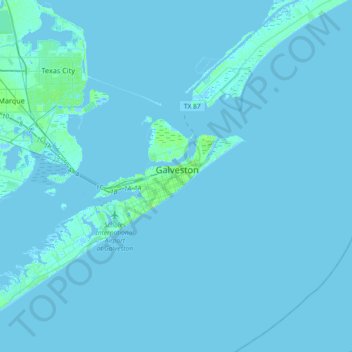
Name: Galveston topographic map, elevation, terrain.
Location: Galveston, Galveston County, Texas, 77553, United States (29.13933 -94.95459 29.45933 -94.63459)
Average elevation: 3 ft
Minimum elevation: -26 ft
Maximum elevation: 75 ft
Other topographic maps
Click on a map to view its topography, its elevation and its terrain.
Galveston Island
United States > Texas > Galveston County > Galveston
Galveston Island, Galveston, Galveston County, Texas, 77554, United States
Average elevation: 7 ft
Campeche Cove
United States > Texas > Galveston County > Galveston > Campeche Cove
Campeche Cove, Galveston, Galveston County, Texas, 77552, United States
Average elevation: 7 ft