
Al Munastir topographic map
Interactive map
Click on the map to display elevation.
About this map
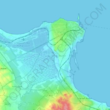
Name: Al Munastir topographic map, elevation, terrain.
Location: Al Munastir, Monastir, Tunisia (35.69171 10.68101 35.78801 10.84365)
Average elevation: 26 ft
Minimum elevation: -10 ft
Maximum elevation: 299 ft
Other topographic maps
Click on a map to view its topography, its elevation and its terrain.
Ksar Hellal
Tunisia > Monastir > قصر هلال > Ksar Hellal
Ksar Hellal, قصر هلال, معتمدية قصر هلال, Monastir, 5070, Tunisia
Average elevation: 43 ft