
Lipez topographic map
Interactive map
Click on the map to display elevation.
About this map
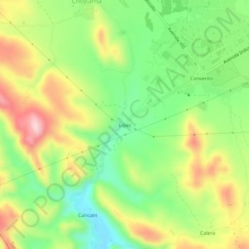
Name: Lipez topographic map, elevation, terrain.
Location: Lipez, Municipio Santiváñez, Capinota, Cochabamba, Bolivia (-17.59099 -66.28281 -17.55099 -66.24281)
Average elevation: 8,432 ft
Minimum elevation: 8,022 ft
Maximum elevation: 8,960 ft