
Bar-le-Duc topographic map
Interactive map
Click on the map to display elevation.
About this map
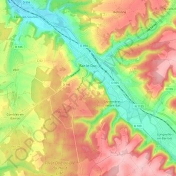
Name: Bar-le-Duc topographic map, elevation, terrain.
Location: Bar-le-Duc, Meuse, Grand Est, Metropolitan France, 55000, France (48.72577 5.12677 48.79819 5.21454)
Average elevation: 830 ft
Minimum elevation: 561 ft
Maximum elevation: 1,089 ft