
El Atazar topographic map
Interactive map
Click on the map to display elevation.
About this map
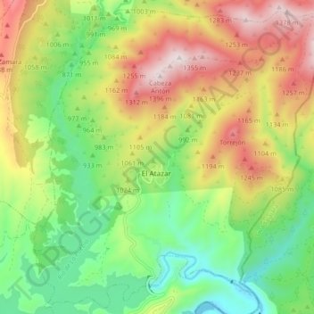
Name: El Atazar topographic map, elevation, terrain.
Location: El Atazar, Sierra Norte, Community of Madrid, Spain (40.90787 -3.50297 40.96732 -3.42155)
Average elevation: 3,314 ft
Minimum elevation: 2,385 ft
Maximum elevation: 4,580 ft