
Puncak Jaya topographic map
Interactive map
Click on the map to display elevation.
About this map
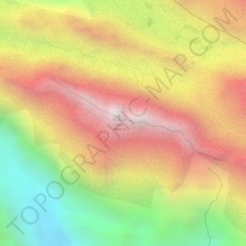
Name: Puncak Jaya topographic map, elevation, terrain.
Location: Puncak Jaya, Mimika, Central Papua, Indonesia (-4.07865 137.15856 -4.07855 137.15866)
Average elevation: 14,012 ft
Minimum elevation: 11,745 ft
Maximum elevation: 15,810 ft
Puncak Jaya (Indonesian: ; literally "Glorious Peak") or Carstensz Pyramid, Mount Jayawijaya or Mount Carstensz (/ˈkɑːrstəns/) on the island of New Guinea, with an elevation of 4,884 m (16,024 ft), is the highest mountain peak of an island on Earth. The mountain is located in the Sudirman Range of the highlands of Central Papua, Indonesia, in the southwest of Puncak Jaya Regency.
Other topographic maps
Click on a map to view its topography, its elevation and its terrain.
Mount Buru
Indonesia > Central Papua > Mimika
Mount Buru, Mimika, Central Papua, Indonesia
Average elevation: 3,327 ft