
Pordenone topographic map
Interactive map
Click on the map to display elevation.
About this map
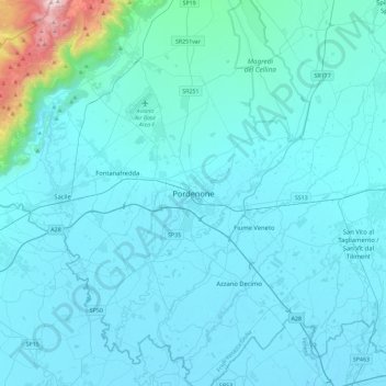
Name: Pordenone topographic map, elevation, terrain.
Location: Pordenone, Friuli-Venezia Giulia, 33170, Italy (45.79625 12.49972 46.11625 12.81972)
Average elevation: 423 ft
Minimum elevation: 7 ft
Maximum elevation: 6,480 ft