
Rhonegletscher topographic map
Interactive map
Click on the map to display elevation.
About this map
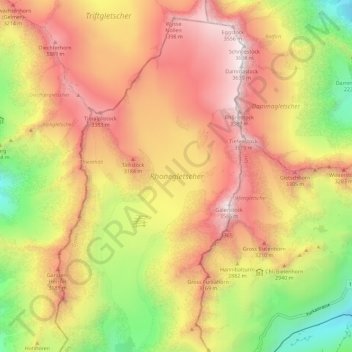
Name: Rhonegletscher topographic map, elevation, terrain.
Average elevation: 9,203 ft
Minimum elevation: 6,181 ft
Maximum elevation: 11,818 ft
Other topographic maps
Click on a map to view its topography, its elevation and its terrain.
Grimselpass
Switzerland > Wallis > Goms > Obergoms
Grimselpass, Obergoms, Goms, Wallis, 3999, Switzerland
Average elevation: 7,067 ft