
Kerco topographic map
Interactive map
Click on the map to display elevation.
About this map
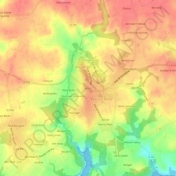
Name: Kerco topographic map, elevation, terrain.
Average elevation: 167 ft
Minimum elevation: 0 ft
Maximum elevation: 266 ft
Other topographic maps
Click on a map to view its topography, its elevation and its terrain.
Kergoalabre
France > Brittany > Finistère > Riec-sur-Bélon
Kergoalabre, Riec-sur-Bélon, Quimper, Finistère, Brittany, Metropolitan France, 29340, France
Average elevation: 154 ft