
La Cuesta topographic map
Interactive map
Click on the map to display elevation.
About this map
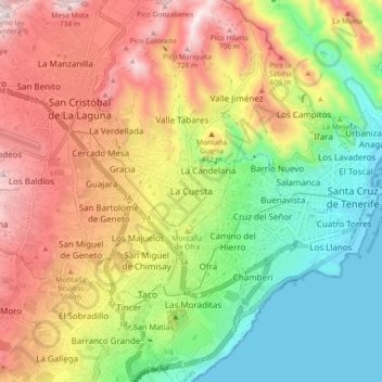
Name: La Cuesta topographic map, elevation, terrain.
Average elevation: 1,112 ft
Minimum elevation: -3 ft
Maximum elevation: 2,464 ft
La Cuesta has an area of 37.06 km² and an elevation of 38 metres.