
Lara topographic map
Interactive map
Click on the map to display elevation.
About this map
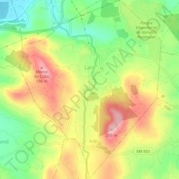
Name: Lara topographic map, elevation, terrain.
Location: Lara, Monção, Viana do Castelo, Alto Minho, North, Portugal (42.02386 -8.54486 42.05285 -8.51390)
Average elevation: 312 ft
Minimum elevation: 13 ft
Maximum elevation: 633 ft