
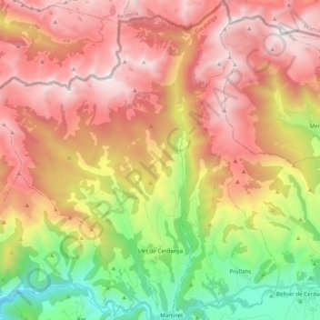
Lles de Cerdanya topographic map
Interactive map
Click on the map to display elevation.
About this map
Name: Lles de Cerdanya topographic map, elevation, terrain.
Location: Lles de Cerdanya, Cerdanya, Lleida, Catalonia, 25726, Spain (42.35829 1.58120 42.50270 1.73021)
Average elevation: 6,243 ft
Minimum elevation: 2,631 ft
Maximum elevation: 9,537 ft
Other topographic maps
Click on a map to view its topography, its elevation and its terrain.