
Days Bay topographic map
Interactive map
Click on the map to display elevation.
About this map
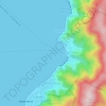
Name: Days Bay topographic map, elevation, terrain.
Location: Days Bay, Lower Hutt, Wellington, 5013, New Zealand (-41.28022 174.90189 -41.28012 174.90199)
Average elevation: 243 ft
Minimum elevation: 0 ft
Maximum elevation: 1,086 ft