
Funabashi topographic map
Interactive map
Click on the map to display elevation.
About this map
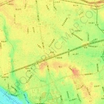
Name: Funabashi topographic map, elevation, terrain.
Location: Funabashi, Setagaya, Tokyo, Kanto, 155-0055, Japan (35.62855 139.60079 35.66855 139.64079)
Average elevation: 148 ft
Minimum elevation: 52 ft
Maximum elevation: 200 ft