
Shoranur topographic map
Interactive map
Click on the map to display elevation.
About this map
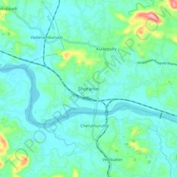
Name: Shoranur topographic map, elevation, terrain.
Location: Shoranur, Ottappalam, Palakkad district, Kerala, 679121, India (10.72372 76.23236 10.80372 76.31236)
Average elevation: 154 ft
Minimum elevation: 39 ft
Maximum elevation: 679 ft
Shornur is located at 10°46′N 76°17′E / 10.77°N 76.28°E / 10.77; 76.28. It has an average elevation of 49 metres (160 feet).