
Birkhadem topographic map
Interactive map
Click on the map to display elevation.
About this map
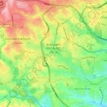
Name: Birkhadem topographic map, elevation, terrain.
Location: Birkhadem, Bir Mourad Rais District, Algiers, Algeria (36.69546 3.02372 36.73257 3.07365)
Average elevation: 371 ft
Minimum elevation: 108 ft
Maximum elevation: 640 ft
Other topographic maps
Click on a map to view its topography, its elevation and its terrain.
Saoula
Algeria > Algiers > Bir Mourad Rais District
Saoula, Bir Mourad Rais District, Algiers, Algeria
Average elevation: 384 ft