
Biliran Island topographic map
Interactive map
Click on the map to display elevation.
About this map
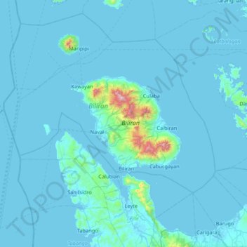
Name: Biliran Island topographic map, elevation, terrain.
Location: Biliran Island, Catbalogan, Eastern Visayas, Philippines (11.26333 124.14667 11.90333 124.78667)
Average elevation: 144 ft
Minimum elevation: -3 ft
Maximum elevation: 4,232 ft