
Irrawaddy River topographic map
Interactive map
Click on the map to display elevation.
About this map
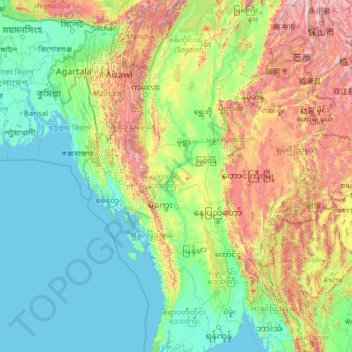
Name: Irrawaddy River topographic map, elevation, terrain.
Location: Irrawaddy River, Magway District, Magway, 08151, Myanmar (16.11399 94.68480 25.70995 97.53597)
Average elevation: 1,437 ft
Minimum elevation: -10 ft
Maximum elevation: 11,565 ft
Other topographic maps
Click on a map to view its topography, its elevation and its terrain.
Minbu District
Myanmar > Magway > Minbu District
Minbu District, Magway, Myanmar
Average elevation: 1,073 ft