
La Vega topographic map
Interactive map
Click on the map to display elevation.
About this map
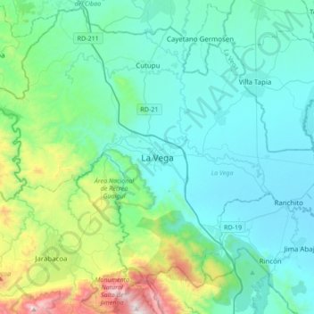
Name: La Vega topographic map, elevation, terrain.
Location: La Vega, 48000, Dominican Republic (19.06374 -70.68841 19.38374 -70.36841)
Average elevation: 1,010 ft
Minimum elevation: 174 ft
Maximum elevation: 4,997 ft