
Pasig topographic map
Interactive map
Click on the map to display elevation.
About this map
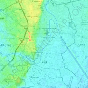
Name: Pasig topographic map, elevation, terrain.
Location: Pasig, Metro Manila, Philippines (14.53378 121.05158 14.62334 121.11103)
Average elevation: 56 ft
Minimum elevation: -7 ft
Maximum elevation: 328 ft
Other topographic maps
Click on a map to view its topography, its elevation and its terrain.