
Altona topographic map
Interactive map
Click on the map to display elevation.
About this map
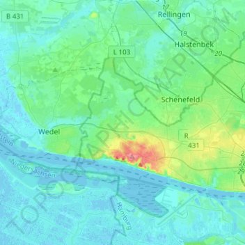
Name: Altona topographic map, elevation, terrain.
Location: Altona, Hamburg, Germany (53.54153 9.73012 53.63140 9.97696)
Average elevation: 43 ft
Minimum elevation: -10 ft
Maximum elevation: 292 ft
Other topographic maps
Click on a map to view its topography, its elevation and its terrain.
21037
Germany > Hamburg > Fünfhausen
21037, Bergedorf, Fünfhausen, Hamburg, Germany
Average elevation: 10 ft