
Ben Smim topographic map
Interactive map
Click on the map to display elevation.
About this map
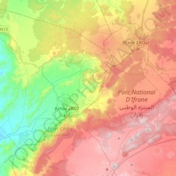
Name: Ben Smim topographic map, elevation, terrain.
Average elevation: 5,148 ft
Minimum elevation: 3,507 ft
Maximum elevation: 6,886 ft
Other topographic maps
Click on a map to view its topography, its elevation and its terrain.
Ain Leuh
Morocco > cercle d'Azrou دائرة أزرو
Ain Leuh, caïdat de Ain Leuh, cercle d'Azrou دائرة أزرو, Ifrane Province, Fez-Meknes, 53052, Morocco
Average elevation: 5,023 ft