
Osborn topographic map
Interactive map
Click on the map to display elevation.
About this map
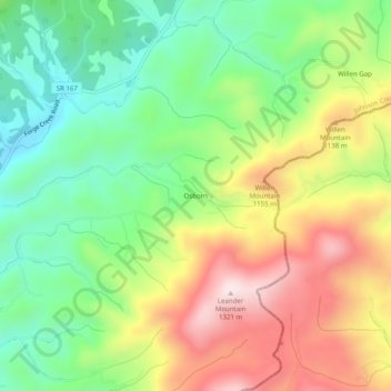
Name: Osborn topographic map, elevation, terrain.
Location: Osborn, Johnson County, Tennessee, USA (36.43484 -81.74567 36.47484 -81.70567)
Average elevation: 3,281 ft
Minimum elevation: 2,513 ft
Maximum elevation: 4,324 ft