
Lycksele topographic map
Interactive map
Click on the map to display elevation.
About this map
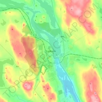
Name: Lycksele topographic map, elevation, terrain.
Location: Lycksele, Västerbotten County, Region Norrland, 921 31, Sweden (64.55586 18.63776 64.63586 18.71776)
Average elevation: 823 ft
Minimum elevation: 633 ft
Maximum elevation: 1,102 ft