
Ballarat Central topographic map
Interactive map
Click on the map to display elevation.
About this map
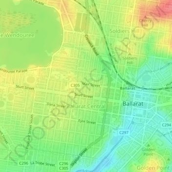
Name: Ballarat Central topographic map, elevation, terrain.
Average elevation: 1,453 ft
Minimum elevation: 1,348 ft
Maximum elevation: 1,575 ft
Other topographic maps
Click on a map to view its topography, its elevation and its terrain.
Poverty Point
Australia > Victoria > Ballarat
Poverty Point, Ballarat, City of Ballarat, Victoria, 3350, Australia
Average elevation: 1,434 ft
Golden Point
Australia > Victoria > Ballarat
Golden Point, Ballarat, City of Ballarat, Victoria, 3350, Australia
Average elevation: 1,427 ft
Golden Point
Australia > Victoria > Ballarat
Golden Point, Ballarat, City of Ballarat, Grampians, Victoria, 3350, Australia
Average elevation: 1,427 ft