
Larzey topographic map
Interactive map
Click on the map to display elevation.
About this map
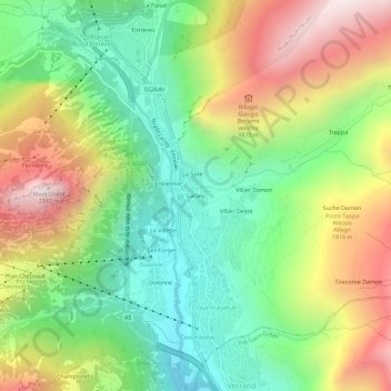
Name: Larzey topographic map, elevation, terrain.
Location: Larzey, Courmayeur, Aosta Valley, 11013, Italy (45.77887 6.95038 45.81887 6.99038)
Average elevation: 5,236 ft
Minimum elevation: 3,593 ft
Maximum elevation: 7,612 ft
Other topographic maps
Click on a map to view its topography, its elevation and its terrain.
Mont Blanc - Monte Bianco
Italy > Aosta Valley > Courmayeur
Mont Blanc - Monte Bianco, Sentiero per Rifugio Monzino, Courmayeur, Aosta Valley, Italy
Average elevation: 13,425 ft
Val Veny
Italy > Aosta Valley > Courmayeur
Val Veny, Courmayeur, Aosta Valley, Italy
Average elevation: 7,057 ft
Ghiacciaio del Miage
Italy > Aosta Valley > Courmayeur
Ghiacciaio del Miage, Sentiero 15 Rifugio Gonella, Courmayeur, Aosta Valley, Italy
Average elevation: 9,551 ft