
Yongning County topographic map
Interactive map
Click on the map to display elevation.
About this map
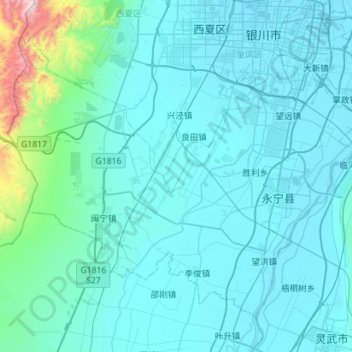
Name: Yongning County topographic map, elevation, terrain.
Location: Yongning County, Yinchuan City, Ningxia, China (38.12602 105.81492 38.48491 106.38002)
Average elevation: 4,012 ft
Minimum elevation: 3,629 ft
Maximum elevation: 9,144 ft