
Heemskerk topographic map
Interactive map
Click on the map to display elevation.
About this map
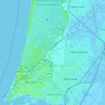
Name: Heemskerk topographic map, elevation, terrain.
Location: Heemskerk, North Holland, Netherlands, The Netherlands (52.48633 4.57149 52.53389 4.72037)
Average elevation: 10 ft
Minimum elevation: -13 ft
Maximum elevation: 157 ft