
Mahabaleshwar topographic map
Interactive map
Click on the map to display elevation.
About this map
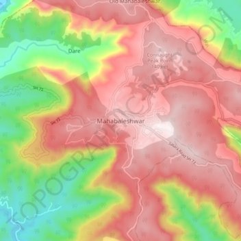
Name: Mahabaleshwar topographic map, elevation, terrain.
Location: Mahabaleshwar, Satara, Maharashtra, 412806, India (17.88428 73.61758 17.96428 73.69758)
Average elevation: 3,648 ft
Minimum elevation: 2,192 ft
Maximum elevation: 4,711 ft
Mahabaleshwar is located at 17°55′25″N 73°39′31″E / 17.9237°N 73.6586°E / 17.9237; 73.6586. It has an average elevation of 1,353 metres (4,439 ft).