
Haaksbergen topographic map
Interactive map
Click on the map to display elevation.
About this map
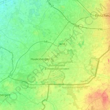
Name: Haaksbergen topographic map, elevation, terrain.
Location: Haaksbergen, Overijssel, Netherlands (52.11807 6.62435 52.20633 6.88975)
Average elevation: 98 ft
Minimum elevation: 33 ft
Maximum elevation: 233 ft
Dutch Topographic map of Haaksbergen (town), June 2014.