
Tennant Creek topographic map
Interactive map
Click on the map to display elevation.
About this map
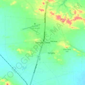
Name: Tennant Creek topographic map, elevation, terrain.
Average elevation: 1,207 ft
Minimum elevation: 1,132 ft
Maximum elevation: 1,411 ft
Other topographic maps
Click on a map to view its topography, its elevation and its terrain.
Nyinkkanyunu
Australia > Barkly Region > Tennant Creek
Nyinkkanyunu, Tennant Creek, Barkly Region, Northern Territory, 0860, Australia
Average elevation: 1,204 ft