
Thank you for supporting this site ❤️
Make a donation
Make a donation
Gear up for your next adventure:
As an Amazon Associate, this site earns from qualifying purchases at no extra cost to you.
Épernay topographic map
Click on the map to display elevation.
Thank you for supporting this site ❤️
Make a donation
Make a donation
Gear up for your next adventure:
As an Amazon Associate, this site earns from qualifying purchases at no extra cost to you.
About this map
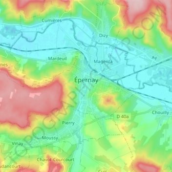
Name: Épernay topographic map, elevation, terrain.
Location: Épernay, Marne, Grand Est, Metropolitan France, 51200, France (49.01798 3.86277 49.06028 3.99365)
Average elevation: 423 ft
Minimum elevation: 207 ft
Maximum elevation: 883 ft
Thank you for supporting this site ❤️
Make a donation
Make a donation
Gear up for your next adventure:
As an Amazon Associate, this site earns from qualifying purchases at no extra cost to you.