
Capelle aan den IJssel topographic map
Interactive map
Click on the map to display elevation.
About this map
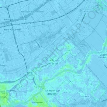
Name: Capelle aan den IJssel topographic map, elevation, terrain.
Location: Capelle aan den IJssel, Rotterdam, South Holland, Netherlands (51.90620 4.53716 51.96550 4.61949)
Average elevation: -3 ft
Minimum elevation: -23 ft
Maximum elevation: 36 ft
Dutch Topographic map of the municipality of Capelle aan den IJssel, June 2015.
Other topographic maps
Click on a map to view its topography, its elevation and its terrain.
Capelle aan den IJssel
Netherlands > South Holland > Capelle aan den IJssel
Capelle aan den IJssel, South Holland, Netherlands, 2902LD, Netherlands
Average elevation: -3 ft