
Beattyville topographic map
Interactive map
Click on the map to display elevation.
About this map
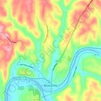
Name: Beattyville topographic map, elevation, terrain.
Location: Beattyville, Lee County, Kentucky, United States (37.56604 -83.72451 37.60320 -83.69198)
Average elevation: 863 ft
Minimum elevation: 640 ft
Maximum elevation: 1,122 ft