
Soma topographic map
Interactive map
Click on the map to display elevation.
About this map
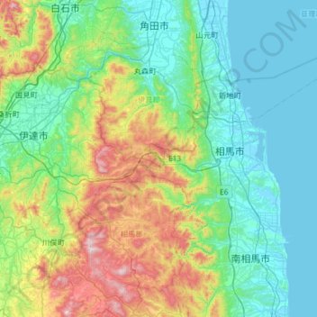
Name: Soma topographic map, elevation, terrain.
Location: Soma, Fukushima Prefecture, Tohoku, Japan (37.59338 140.64487 37.97509 141.22148)
Average elevation: 682 ft
Minimum elevation: -10 ft
Maximum elevation: 2,936 ft
Other topographic maps
Click on a map to view its topography, its elevation and its terrain.