
Georgetown topographic map
Interactive map
Click on the map to display elevation.
About this map
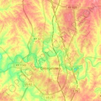
Name: Georgetown topographic map, elevation, terrain.
Location: Georgetown, Scott County, Kentucky, 40324, United States (38.17693 -84.60207 38.27794 -84.50419)
Average elevation: 869 ft
Minimum elevation: 725 ft
Maximum elevation: 971 ft
Other topographic maps
Click on a map to view its topography, its elevation and its terrain.
Stamping Ground
United States > Kentucky > Scott County
Stamping Ground, Scott County, Kentucky, United States
Average elevation: 823 ft
Sadieville
United States > Kentucky > Scott County
Sadieville, Scott County, Kentucky, 40370, United States
Average elevation: 850 ft
Herdon
United States > Kentucky > Scott County > Herdon
Herdon, Scott County, Kentucky, United States
Average elevation: 866 ft