
Buffalo topographic map
Interactive map
Click on the map to display elevation.
About this map
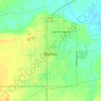
Name: Buffalo topographic map, elevation, terrain.
Location: Buffalo, Harper County, Oklahoma, 73834, United States (36.82626 -99.64029 36.84703 -99.62026)
Average elevation: 1,808 ft
Minimum elevation: 1,762 ft
Maximum elevation: 1,854 ft
Other topographic maps
Click on a map to view its topography, its elevation and its terrain.
Laverne
United States > Oklahoma > Harper County > Laverne
Laverne, Harper County, Oklahoma, 73848, United States
Average elevation: 2,123 ft