
Perumbavoor topographic map
Interactive map
Click on the map to display elevation.
About this map
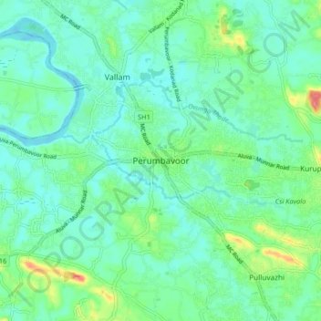
Name: Perumbavoor topographic map, elevation, terrain.
Average elevation: 66 ft
Minimum elevation: 0 ft
Maximum elevation: 269 ft
Other topographic maps
Click on a map to view its topography, its elevation and its terrain.
Kuruppampady
India > Kerala > Kunnathunad
Kuruppampady, Kunnathunad, Ernakulam District, Kerala, 683545, India
Average elevation: 92 ft
Airapuram
India > Kerala > Kunnathunad
Airapuram, Kunnathunad, Ernakulam District, Kerala, 683541, India
Average elevation: 85 ft
Vengola
India > Kerala > Kunnathunad > Perumbavoor
Vengola, Perumbavoor, Kunnathunad, Ernakulam District, Kerala, 683500, India
Average elevation: 75 ft
Nellad Junction
India > Kerala > Kunnathunad
Nellad Junction, Kunnathunad, Ernakulam District, Kerala, 686669, India
Average elevation: 85 ft